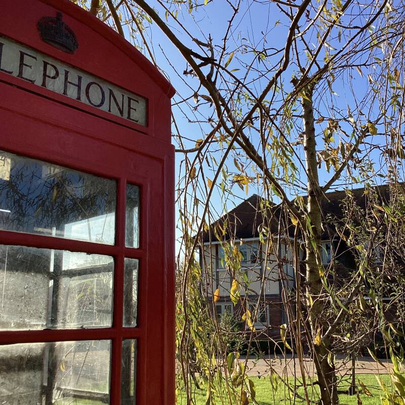
HORNCHURCH and UPMINSTER

C2C takes you to UPMINSTER from FENCHURCH STREET sta

HORNCHURCH

The London Borough of Havering describes well this district: “With over 150 shops and restaurants to choose from, ranging from independent specialist retailers to high street names, Hornchurch is a pleasant and vibrant place to visit whether you are going shopping, or having a meal and taking in a show.
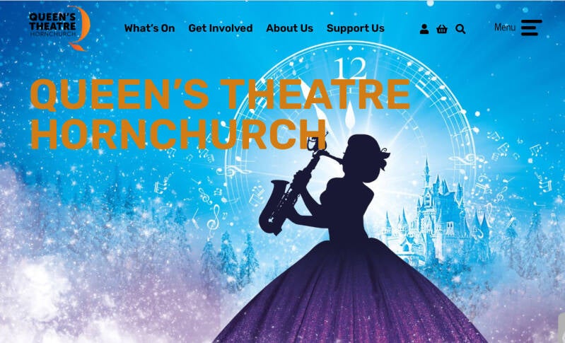
The historic town has a unique character, being a flagship cultural centre for the borough of Havering. It boasts the popular Queen's Theatre, home to England's only resident company of actor-musicians.
And period Grade II listed buildings like Fairkytes Arts Centre, which offers arts and craft workshops, and Langtons House, a beautiful venue for weddings, civil partnerships and other ceremonies.
Recent improvements to the town centre have seen improved traffic flow and created a pleasant and accessible environment for pedestrians using the high street”.
According to WIKIPEDIA “it is located 15.2 miles (24.5 km) east-northeast of Charing Cross. It comprises a number of shopping streets and a large residential area. It historically formed a large ancient parish in the county of Essex that became the manor and liberty of Havering. The economic history of Hornchurch is underpinned by a shift away from agriculture to other industries”. HIDDEN LONDON says that “leather remained at the heart of Hornchurch’s commercial life until the 19th century, with shoemakers, tanners and dealers in animal skins” and that “the town centre was heavily redeveloped in the late 1960s and early 1970s but some valuable older houses were preserved”
A village
In 1897 Hornchurch had a population of 4,200. It was a large village with scattered groups of houses throughout rest the parish and in the northwest the built up area of Romford extended into it.[14] The growth of Hornchurch from rural village to suburban town began with the sale of the southern 200 acres (0.81 km2) of Nelmes manor for the Emerson Park housing estate of 200 homes in 1895.[24] In 1901 the 241 acres (0.98 km2) northern portion of Nelmes was sold for the Great Nelmes housing estate.[7] Emerson Park railway station was opened in 1909 to serve the new estates.[25]


LU District Line Station
When you come off HORNCHURCH LU station you can choose, town or country…
Country
The Ingrebourne Valley: a short walk to UPMINSTER


Town walk from LU STATION: Alongside STATION LANE
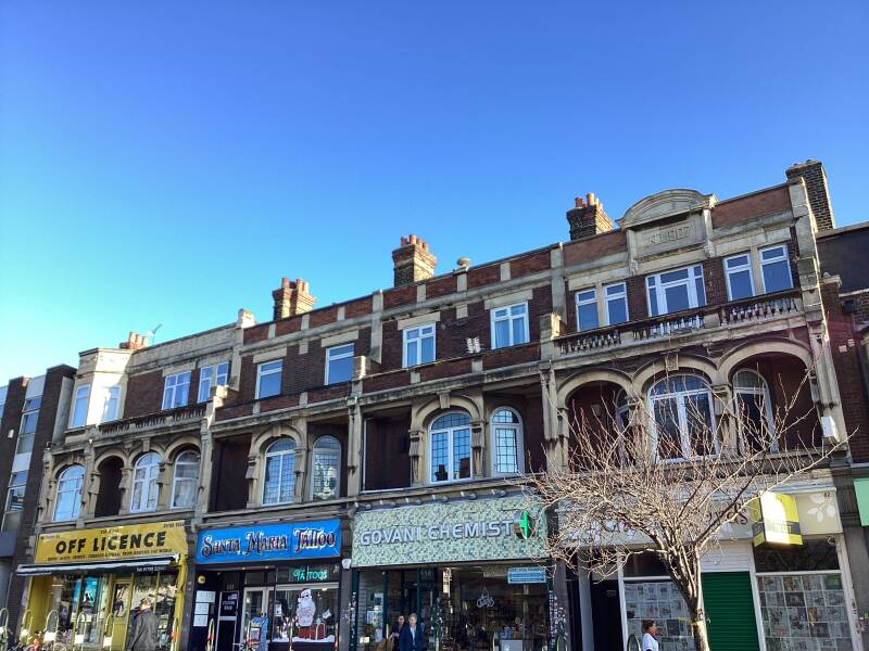
SHOPS and EATERIES
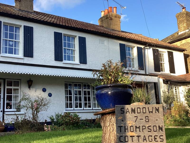
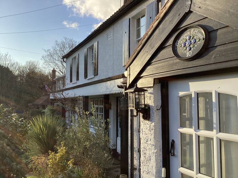
HOMAGE TO JACK CORNWELL: COTTAGES FOR DISABLED EX-RN SERVICEMEN
I transcribe from LONDON REMEMBERS:
The Romford Recorder provides: "East Ham mayor Robert Banks-Martin had led his borough in mourning when Jack was buried at Manor Park. In 1928, he organised a national memorial to the boy hero, six cottages for disabled ex-Royal Navy men. An architect by profession, Banks-Martin lived in Woodlands Avenue, Emerson Park. He probably designed the memorial, and chose its location .... The garden paths were arranged to form the letters VC."
The houses are now managed by the Royal Naval Benevolent Trust. As far as we know, Jack Cornwell himself had no connection with this area.
The plaque is on the left hand pillar.
If you choose town head towards UPMINSTER ROAD
To the East (or coming from UPMINSTER)
High St. and Upminster Rd.

ST.ANDREW’S CHURCH

The medieval St Andrew’s church was partially rebuilt in 1802 and restored again in 1869. Subsequent renovations have included a stained-glass window featuring a red Ford Fiesta car.
SITE OF HORNCHURCH PRIORY (opposite the church)
Hornchurch Hall originated as an adaptation of the Priory after its dissolution in 1391 and its purchase by New College, Oxford. The priory had been founded in 1163 but in 1399-1400 after its dissolution it was split, the rectory at the western end becoming the Hall, the vicarage at the east end becoming the Chaplaincy.
In 1923 the Hall was a house of C16 date with a C17 chimney, the south front being an addition of the late C18 or early C19. It was demolished 1941.
A photograph in YE OLDE VILLAGE OF HORNCHURCH shows the building in 1917.
The Old Chaplaincy, retaining some C17 parts, remains opposite the church.
The site is now occupied by a youth club. There is no conclusive evidence to suggest that there was a moat at this location.
It was founded in 1158/9 on land donated by Henry II to the Hospital of St Nicholas and St Bernard. In 1163 the St Andrew's Church and adjacent land (Hornchurch Hall manor) was given by Henry II to the priory. The monastic house was thud established on this land to the north of the church and was dedicated to St Nicholas and St Bernard. Land holdings were increased by 360 acres (1.5 km2) gifted by local landowners. For over 200 years the priory dominated the spiritual life of Havering as well as acting as landlord over much of Hornchurch. Its lands were seized by the Crown in 1385 and bought for New College, Oxford in 1391.
A Mediaeval Coin Hoard!

:446 silver pennies of c. 1223 to soon after 1260 AD. found 13.8.1938 eighteen inches from surface of the ground
Yes, the famous dogs from Switzerland
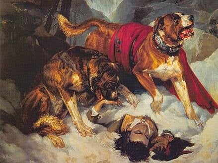
The St Bernard dog breed was created at the hospice from cross-breeding dogs, probably those offered by families in Valais in the 1660s and 1670s. The first definite mention of the breed is in 1709. The breed was originally raised to provide guard dogs for the hospice, before they became mountain rescue dogs.
NOW AN ELECTRICAL SUBSTATION AND THE MILLFIELD RECREATIONAL GROUND. A former boxing ring?
A gently sloping bowl known as the Dell was a popular setting for wrestling matches and other sporting events, especially in the 18th century, and possessed one of the best-known cockpits in the London area. The Dell lay to the south-west of the church in the Mill Field, which was possibly the site of the monastery and is now a recreation ground.
In 1795 ‘Gentleman’ John Jackson defeated the ‘Whitechapel whirlwind’ Daniel Mendoza in a famous fight at the Dell. Jackson’s ungentlemanly technique included holding Mendoza by his hair while punching his head with his other hand. After that match, boxers rarely wore their hair long.
More about the great Eastender Jewish pugilist


This is a well known to geologists as the most southerly place in England that glacial boulder clay, or till, has been discovered, therefore marking the maximum southerly extent of the ice sheet during the whole of the Ice Age. Glacial till has also been found in The Dell, which makes this site of geological interest with potential for further research. The geology revealed by any excavations in The Dell should be recorded.
High St.
In the 13th this was called Pell (Pelt) Street. It was an area of leather working and the last of three tanneries closed only in the 19th.


Mill Park Avenue. Sort of METRO-LAND


THE FATLING PH
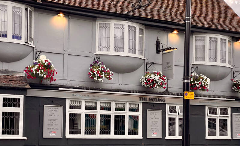
Sandy Castle, general manager of The Fatling, gave an insight into the high street venue's history, revealing that it was even a "topless barmaid pub" back in the 1970s.
She said: "It's got quite a colourful background.
Now, I would better leave you with theROMFORD RECORDER article…
J.J.MOON’S PH, the local Wetherspoon pub


Inspired in GEORGE ORWELL’s type of pub
Site of the TOWERS CINEMA


Demolished only in 2017!!!
site of brewery, bicycle factory (Speedwell >Ormond)?
THE RAVENSBOURNE RIVER. BRIDGE
This is the Ravensbourne in Havering, not the long and important river of the same name in southeast London. It flows south between Romford and Hornchurch, missing both. Read on this post from DIAMOND GEEZER!
The park was established by Hornchurch Urban District Council in 1936 when the council purchased the 42 acres (0.17 km2) of Harrow Lodge Farm from the London County Council for £16,250. A further 34.86 acres (0.1411 km2) were added to the park when Costain, developers of Elm Park Garden City, donated land to the council as part of a planning agreement.
HARROW LODGE LEISURE CENTRE

No.37?

ST.LEONARD’S CHILDREN’S COTTAGES.
Conservation area


The Shoreditch Guardians of the Poor opened Hornchurch Cottage Homes in 1889. They continued in use as children's homes until 1984 - a full 95 years of residential childcare.
The homes were on Hornchurch Road. At the time, being moved to Hornchurch from Shoreditch must have been quite a culture shock, leaving behind the crowded, poor environment of London.
Like many cottage homes, it was laid out on a private street, with eleven detached two-storey cottages, each one housing 30 children. On site, there were three schools - for boys and girls and infants, a swimming pool, a band room, stores, workshops (in which children used practical skills such as carpentry and shoe-mending) and an infirmary. When the home closed in 1984, a a new housing estate was built in its place.


Along Billet Lane, North of the High St
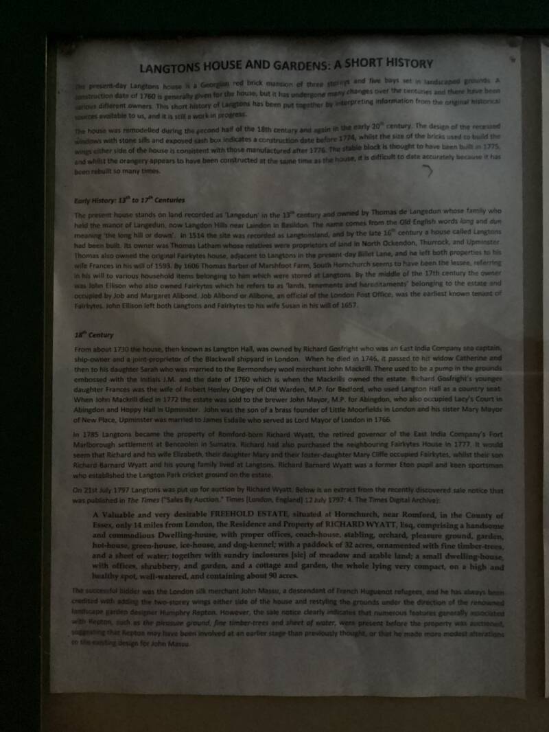
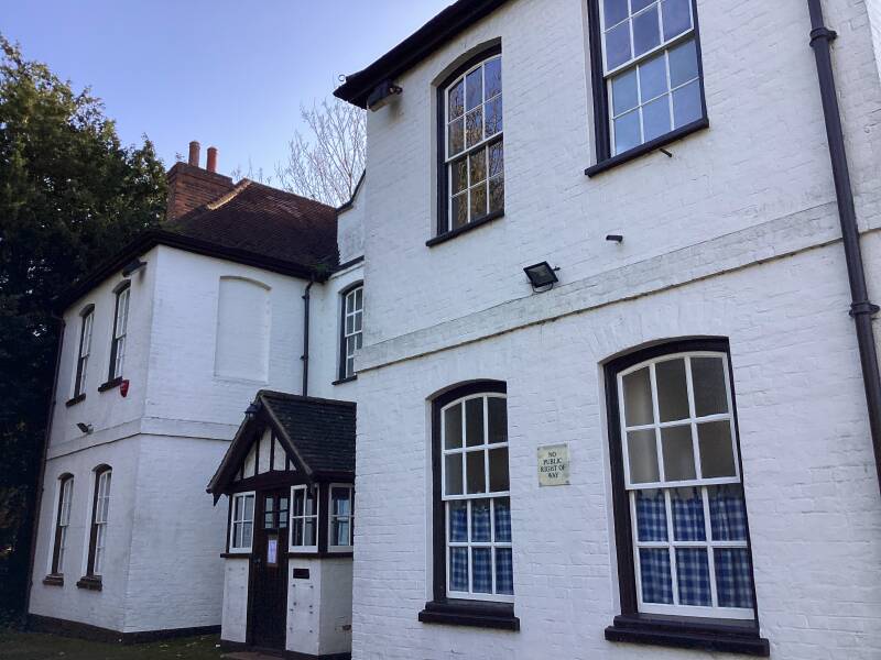
LANGTONS HOUSE


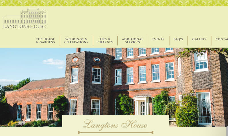
Langtons House is a Grade II Listed 18th Century manor house. The house stands in the picturesque landscaped gardens with an ornamental lake, orangery and bath house all dating from the eighteenth century.
The House belonged to the Massu family, Huguenot refugees from France, who became wealthy silk merchants in the City of London.
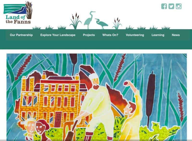
In 1797 Langtons as it was once again known was purchased by John Massu, a wealthy man of Huguenot extraction when it was put up for auction by Richard Wyatt. Massu modernised Langtons adding two two-storey wings to the house. It was John Massu who commissioned Repton to weave his magic on the four or so acres of garden. Professor Ged Martin in the Romford Recorder describes Langtons as ‘a gem, a bit of Kew Gardens in the middle of Hornchurch.’ Repton didn’t hold back when he set about constructing a serpentine lake, an orangery, a glasshouse (now used for weddings) and a gazebo. The bath house that stood next to the lake came later, in the early 19th century. The Land of the Fanns website, a five year partnership to rediscover and herald London as it once was, notes that Repton’s design incorporated paths, walls, a lake, gardener’s bothies, a ‘mazy’ shrubbery, an enclosed orchard and fine timber trees.
John Massu died in 1807 and is buried in the Essex village of Paglesham. His widow Mary continued to live at Langtons until her death in 1850.
The house was given to Hornchurch Urban District Council in 1929 under the condition that the building must be used for council purposes and the four acres of grounds remain open to the public.
A great article from ESSEX LIFE
Huguenots in England?. Visit SPITALFIELDS

More about LANGTONS


Homage to the designer of the original garden here, HUMPHRY REPTON
FAIRKYTES ART CENTRE


Fairkytes was a private house originally built in the mid 18th century with several later additions to the property made up to the end of the 19th century. It is Grade II listed.
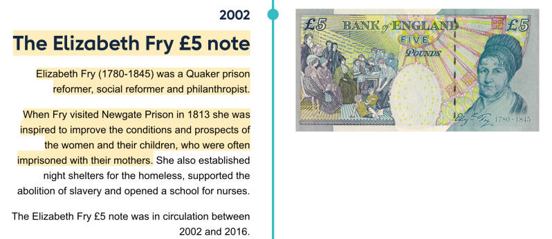
Previous occupants include Job Alibone, Joseph Fry (son of the famous prison reformer Elizabeth Fry) and Thomas Wedlake, who owned the Iron Foundry which stood opposite. In the 1950s it was bought by Hornchurch Urban District Council who used it as a library.
Fairkytes became Havering's Arts Centre in 1973 when the library moved to the purpose built building in North Street. Over time the centre has grown considerably, incorporating the Annexe building at the rear in 1992 and the Billet building next door in 2001.
Joseph Fry’s mother, Elizabeth
From HORNCHURCH to the BANK OF ENGLAND MUSEUM…
QUEEN’S THEATRE

HOP INN, a micropub
Alison Taffs and husband Phil Cooke have run The Hop Inn in North Street in since 2019 and the venue has recently been recognised with the London Cider Pub of the Year 2024 award.
The accolade, given by the Campaign for Real Ale (Camra), was won for the fourth consecutive year by The Hop Inn. The venue was also recognised as one of the top 16 boozers in the UK in 2022.

You are now very close to EMERSON PARK OVERGROUND STATION
Site of NELMES MANOR HOUSE
Demolished. Romford recorder
UPMINSTER


Buses from UPMINSTER BRIDGE

Buses from UPMINSTER


As you will see, there are plenty of links to TONY BENTON’s site


Thanks to JULIAN WHITE for this walk. Have a look to all his LONDON posts, and the ones of his journeys all over the WORLD


If you come off the station, turn into STATION ROAD Southwards, towards the town centre
1907…Edwardian
Hang on, look up, TAYLOR WALKER?.

ROOMES and a former CINEMA?


A family department store
TRINITY CONGREGATIONAL CHURCH

The United Reformed Church(URC) is a Protestant Christianchurch in the United Kingdom. As of 2024 it had approximately 44,000 members in around 1,250 congregations with 334 stipendiary ministers.[2]
The URC is a trinitarian church whose theological roots are distinctly Reformed and whose historical and organisational roots are in the Presbyterian(Calvinism) and Congregationaltraditions. Its Basis of Union contains a statement concerning the nature, faith and order of the United Reformed Church which sets out its beliefs in a condensed form.
BYRON PARADEE. CORBETS TEY ROAD. Art Deco


Vinyl!


Have you ever wondered how Byron Parade in Corbets Tey Road came to be named after Lord Byron, one of Britain’s most famous poets? Or wanted to know what the site was before this 1930s shopping parade was built or who were the people who lived there? Wonder no more! Read the rich and varied history of High House, Upminster and its occupiers. Read TONY BENTON’s OLD WESTMINSTER
Library exhibition
After Station Rd., St.MARY’S LANE, Westwards (Towards HORNCHURCH)
ST.LAURENCE’S CHURCH

In 653 AD, St Cedd, a monk from Lindisfarne, was sent to Essex as a missionary. Cedd landed at Bradwell-on-Sea, where he founded a minster - a church base for clergy to teach the Christian faith in the surrounding area. Over the next ten years Cedd established four more minsters, including at a major Roman crossroads above the Thames, now known as Upminster.
ST.LAURENCE HOUSE, GRIDIRON PLACE. Former RECTORY

Until 1929 Upminster Park to the south of the church along Corbets Tey Road was the parish Glebe, the area of land which provided extra income for the Rector, alongside the tithes which were levied on the harvest from the whole parish.
Site of HIGH HOUSE
ST.JOSEPH RC CHURCH

FORMER HOUSE, FORMER CONVENT, now residential again

Work was completed in early 2017 on the transformation of the former convent of the Sacred Heart of Mary on Upminster Hill to form seven apartments, with the addition of two five-bedroom houses to the south – collectively known as Numbers 1-9 Convent Close, St Mary’s Lane. It’s timely to explore the story of this little-known property, which for much of its history was a family home.
THE OLD CHAPEL and the SACRED HEART OF MARY SCHOOL
The Old Chapel was built in 1800 as an alternative place of worship for Protestant Dissenters. This group were known as ‘Dissenters’ because they moved away from the established church. In Upminster, this was partly due to a dispute over tithe payments (payments made by parishioners to the parish church to fund its upkeep). The congregation of the Old Chapel then grew steadily throughout the Victorian era.
This group worshipped at the Old Chapel until 1911. The growth of Upminster as a garden suburb led to the number of worshippers at the Old Chapel increasing. The decision was taken to move to new premises. Trinity Church on Station Road in Upminster was built to accommodate the congregation.
Another Christian group, the Brethren, then worshipped at the Old Chapel from 1911 – 1989.

In 1927 nuns from the Religious of the Sacred Heart of Mary bought Hill Place for use as a convent, naming it the Convent of the Sacred Heart of Mary. Hence the school has been colloquially known as "Upminster Convent School". It was established as a small independent fee-paying day and boarding school called "Convent Collegiate School"[2]catering for girls of all ages and boys up to the age of eight.[3]
As in 2024, a Catholic girls' secondary school with academy status Judged by OFSTED to be outstanding, Ofsted described it then as a smaller-than-average secondary school with an average racial mix. The largest minority ethnic group is Black African heritage. A smaller than average group of students is eligible for the pupil premium ;the additional government funding for looked-after children, students known to be eligible for free school meals and children of service families, similarly the number of disabled students, students with special education need statements or entitled to catch-up funding.[14]
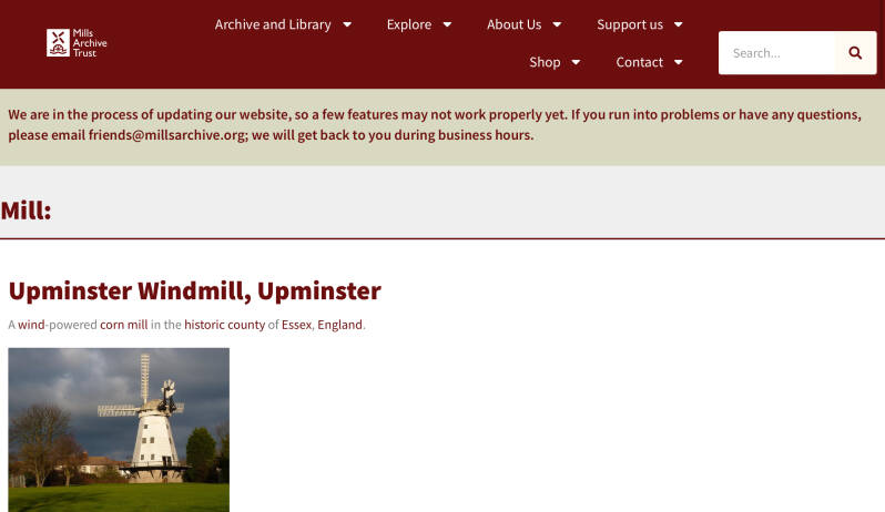
UPMINSTER MILL

Here you have the history part of the web
London mills

Mills around the World!
BRIXTON WINDMILL

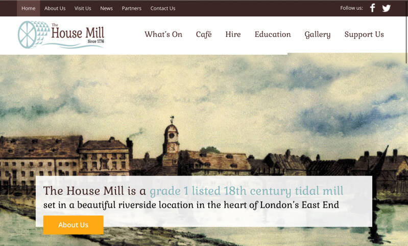
THREE MILLS ISLAND A tide mill.
INGREBOURNE COTTAGES, THE FORMER WORKHOUSE

Now surviving as Ingrebourne Cottages) was built in 1750 and extended in 1786.
UPMINSTER BRIDGE
Buses To UPMINSTER and HORNCHURCH

Upminster Bridge is a crossing of the River Ingrebourne carrying the A124 road between the suburbs of Hornchurch and Upminster in northeast London, England.[1] The bridge is known to have existed since at least 1375[2] and the current brick bridge was opened in 1892, replacing a series of wooden bridges. It gave its name to the nearby Upminster Bridge tube station, which opened in 1934, and has also been applied to the neighbourhood around the station in the London Borough of Havering.
Or you can explore the other side of ST.MARY’S LA E
After Station Rd., ST.MARY’S LANE, now Eastwards


Interesting businesses, and Art Deco architecture


THE CLOCK HOUSE and gardens


Attention, you are back in the STATION: from here, you are heading N but -mind you!-you will end up in CORBETS TEY, S of Upminster
To the North of Upminster (North of the station)
The Fairway (road)
ORONSAY HOUSE
A lone modernist house in the suburbs of Upminster, designed by David F. Lumley of the Fowles and Lumley, apparently for the engineer of theP&O SS Oronsay.
More about ORONSAY house

Carry on reading the blog…
TITHE BARN

The barn, originally part of the Home or Hall Farm of nearby Upminster Hall, is a large timber framed structure clad in a mixture of horizontal and vertical boarding, capped by a thatched roof. It is of a box-frame construction with aisled sides, consisting of nine bays with central midstrey and a gabled porch on the northern side and measures some 138 feet long by approximately 40 feet wide.
Although now known locally as the “Tithe” barn, no evidence has been found that Waltham Abbey or other owners of the manor of Upminster Hall, to which the barn belonged, ever possessed the right to tithes.
UPMINSTER HALL
Now, the clubhouse

King Harold II gave the manor of Upminster Hall to the abbots of Waltham Abbey in around the year 1050.[1] The present house, which dates from circa 1500, remained in the ownership of the abbey until the Dissolution of the Monasteries in 1536, when King Henry VIII gave it to Thomas Cromwell.[1] It was then occupied by the Latham family from 1543 until it passed to Edward Noel, later 1st Earl of Gainsborough, in 1677.[2] It was then owned by the Branfil family from 1685 until it was bought by Major Godfrey Pike in 1921.[1] It became the clubhouse of Upminster Golf Club in 1927[3] It has been listed Grade II* on the National Heritage List for England since January 1955.[4]
CRANHAM
HIDDEN LONDON’s awesome article describes pretty well the area and introduces to its main landmarks
Conservation area

Shops and eateries
Along Front Lane, Southward
ST.LUKE CHURCH

St Luke's is the Parish church, established in the 50's as Cranham began to grow from a tiny hamlet to an established large village. The parish now has around 13,000 residents - more than enough for any one church to try and serve effectively.
Bungalows and a pond…

Nearby
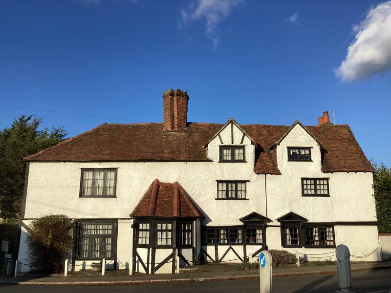
THE THATCHED HOUSE PH
Alongside The Chase
Chase?
Chase is a term used in the United Kingdom to define a type of land reserved for hunting use by its owner. Similarly, a Royal Chase is a type of Crown Estate by the same description, where the hunting rights are reserved for a member of the British Royal Family.
The term ‘chase’ is also used in Australia to describe some national parks. Flinders Chase National Park is on Kangaroo Island in South Australia and Ku-ring-gai Chase National Park is in New South Wales.
Fox hunting, here?. Soho!!!. Tally-ho!!!

The name is generally accepted to have come from an ancient hunting cry; apparently ‘tally ho!’ is the cry when a fox breaks cover and ‘soho!’ is when huntsmen uncouple the dogs.
THE TALLY HO PH, North Finchley

Taïaut, in French

MAGNOLIA HOUSE


FOUR OAKS

RECTOR’S COTTAGE & THE OLD RECTORY

From now on (church) you are following the UPMINSTER CIRCULAR WALK

ALL SAINTS CHURCH


CRANHAM HALL
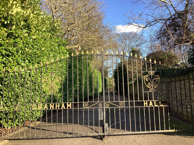
Thank you Savills for allowing us to know what is behind those gates!.

The previous incarnation of Cranham Hall was the home of General James Oglethorpe, founder of the American colony of Georgia. He died at the hall in 1785 at the age of 89. Oglethorpe has given his name to the local primary school – and to a university in Atlanta. Streets laid out for council housing in Cranham have names with Georgian connections.

More history thanks to historian ANDY GRANT, published in part 1 and part 2 in
Andy Grant writes a weekly history column for the Romford Recorder, taking a deep dive into the area's quirky, fascinating and surprising heritage. And more heritage, here!


COOPERS COMPANY AND COBORN SCHOOL. Coopers?


The Nicholas Gibson Free School was founded in 1536 by Nicholas Gibson, a prominent citizen of the City of London who earned his living as a grocer. On his death in 1549 Gibson's wife, Avice, took over the running of the school, which could take up to sixty boys. In 1552 she asked the Coopers' Company to undertake the management of the school for her, and thus the school included the company's title in its name. The school was situated in Ratcliff, on the north side of the River Thames between Shadwell and Limehouse which is now a district of the London Borough of Tower Hamlets. Schoolhouse Lane is still there and marks the place where the School and the Coopers' Company's Almshouses were located for over three hundred years.
Prisca Coborn (née Forster), the widow of a brewer (Thomas Coborn/Colbourne), established a coeducational school in Bow in 1701 as a result of the terms of her will, registered in the year of her death (1701), investing the school with lands let to tenants in Bow, Stratford and Bocking.[2] She is buried in Bow Church.
The cooper trade involved the making of wine, beer, and spirit casks (a barrel is specifically a 36-gallon cask, or 32 in some circumstances); the Livery Company also functions as a charitable foundation, and supports two education establishments: the Coopers' Company and Coborn School of Upminster, Essex, and Strode's College of Egham, Surrey.
Farmland in Greater London

Not many buildings in the area, towards the end of the 19th c.


CRANHAM MARSH NATURE RESERVE


A woodland oasis located inside the M25, this relic marshland is a prime example of what the countryside would have looked like
UPMINSTER CEMETERY

Upminster Cemetery dates from 1902 to provide for the growing population of Upminster parish. Built on a rectangular piece of land to the east of Corbets Tey hamlet, the cemetery was simply laid out with a central roadway leading to a small mortuary chapel towards the back of the plot. At that time the cemetery was surrounded by open land, and this is not much changed even today. The South Essex Crematorium was built on adjacent land in 1956/7, and the original cemetery land was itself extended to the north, with further expansion by 1989 to the east.
A cross-over style


CORBETS TEY
As the story that Elizabeth I said to her servant, “Corbet, stay and ask the name of this place” and when she was told that it had no name, decreed that it be called after her first words, is no more than a legend, and somewhat more likely is that Corbin was the landowner and Tey comes from the Old English ‘tye’ or enclosure, I leave you with the rest of HIDDEN LONDON article.
Suburbia and a Conservation area


Café

Pub


Montroig (house)


Route 370 takes you to UPMINSTER, HORNCHURCH and ROMFORD
To the East,
NORTH OCKENDON
Conservation area


Again, enjoy HIDDEN LONDON’s description of the district
To the West
HACTON

If you want to carry on exploring…


THE FOREST CENTRE, Broadfields, Pike Lane

The Thames Chase Forest Centre is located near Upminster. Forestry England manage the 56 hectares (140 acres) of new woodlands, meadows and ponds at the site for the benefit of people, nature and the climate.
Opening hours:
10am-5pm weekdays and weekend (10-4pm in the winter from Oct 31st). (The Forest Centre Tea Room serves hot food until 3pm during winter months)


The Thames Chase Community Forest is a community forest of 9842 hectares (24,320 acres/38 square miles) [1] located in 47 sites in London and Essex, England. Established in 1990, the community forest is administered by the Thames Chase Trust, with a stated aim "to renew and regenerate the landscape at the edge of East London and South Essex by creating a varied wooded landscape for local people to influence, create, use, enjoy and cherish".
THAMES CHASE: Other places to visit

DAGENHAM & ROMFORD

AVELEY & OCKENDON

BRENTWOOD
