A ROYAL PALACE. HANG ON!. ROYALTY… HERE?
From ROMFORD to HAVERING-ATTE-BOWER
Only one route: 375 from ROMFORD, only Mon-Sat, NOT high frequency!

A Walk suggestion


I have been inspired by these two publications, and I have transcribed almost literally, a lot of their content.


Awesome post from an awesome blog, here you have the introduction:
Once upon a time, in an Essex village called Havering-atte-Bower (now part of London), sat a palace. Many kings stayed in the palace during their travels around the country until it was abandoned in 1686. Today, nothing remains of the palace, and not many people know it ever existed. Fortunately, records of the building still exist, and the Romford Historical Society is determined to keep the history of Havering Palace alive.


HAVERING HERITAGE
A bit of history…
The history of Havering dates back at least to Saxon times, with the format of the name indicative of an early Saxon settlement[3] while archaeological finds in and around Havering Country Park suggest a Roman villa or similar structure in the area.
The name is recorded in the Domesday Book of 1086 as Haueringas. It is an ancient folk name meaning settlement of the followers of a man called Hæfer. The name is recorded as Hauering atte Bower in 1272. The atte Bower suffix means at the royal residence and refers to Havering Palace, which was situated here. The West London equivalent to Havering-atte-Bower is Old Windsor in Berkshire, which had a Saxon Palace that predated Windsor Castle. Edward the Confessor would have travelled to and from his palaces at both Havering-atte-Bower and Old Windsor. Both villages are situated on high ground and have great views into London.
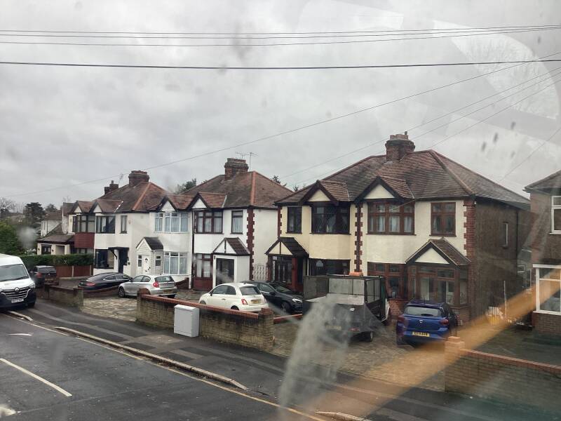
On the bus 375 from ROMFORD…
BUS GARAGE

Alongside TFL bus 375 route: London suburbs


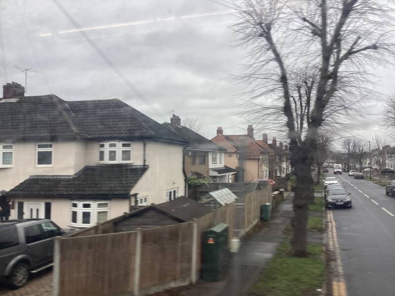


COLLIER ROW


HAVERING-ATTE-BOWER

Conservation Area


Havering-atte-Bower is a beautiful conservation village on the outer edge of the London Borough of Havering, located 15 miles northeast of Charing Cross and close to the Greater London boundary. It is situated 344 feet above sea level with striking views of east London, Essex and Kent. The village has been the location of a number of palaces and large houses including Bower House, The Round House, Pyrgo Palace and Havering Palace. The village is surrounded by three large parks; the dense woodlands of Havering Country Park (site of one of only two redwood plantations in England, imported from California); Bedfords Park; and Pyrgo Park.
THE ORANGE TREE PH


In 1762 there were two inns in the parish, the Royal Oak and the Orange Tree. The Orange Tree, which gave its name to Orange Tree Hill, continues in a modern building. The Royal Oak, recorded from 1744, gave up its licence in 1792. A later house of that name, in North Road, has been trading since around 1920.
BOWER HOUSE


A small Palladian mansion built in 1729 by John Baynes from plans by Henry Flitcroft. Reputedly built with some of the bricks from the demolished HAVERING ROYAL PALACE. The rooms were not overly large, but elegant, and the house had extensive grounds. The staircase was once decorated with paintings by Sir James Thornhill. An inscription in the entrance hall states that remains of the royal house were used in the building, and a stone corbel with the arms of Edward III is preserved in the hall. It is believed that Charles Bridgeman, the designer, laid out the grounds. Around 1800, the east and west wings were added and in the mid 19th century the main room in the east wing was fitted with paneling in 17th-century style, with an original fireplace, dated 1659.
The Bower House was originally built for Mr Serjeant Baynes who was a distinguished lawyer. Bower House remained a private home until 1976 when it was taken over by the Ford Motor Company as a training centre. It is now a residential training centre operated by the Amana Trust a Christian charity.

Amana Trust is a Christian charity that distributes the ministry ofWatchman Nee and Witness Lee. Amana Trust is the only UK distributor of the complete works of Watchman Nee and Witness Lee. We sell books and Bibles and sponsor the Life-study of the Bible with Witness Lee, a radio programme on Premier Christian Radio. Many of the books and resources are freely available online.
Cross to the other side of the road and continue past the Orange Tree Pub to Bower House (J). Take the 'Permissive Route to Bedfords Park signposted just after Bower House on the left. Follow the track until you reach the woods, at the T-junction bear right. At the gate tyrn right and follow Footpath No14, then continue straight ahead. As you come out of the woods go straight ahead towards the field, Bedfords Park Car Park will be on your left.
BEDFORDS COUNTRY PARK


Uprooted
VISITOR CENTRE and the area around it, site of the BEDFORDS, the house
The name Bedfords is thought to derive from a John Bedford or Bedforde who owned land in the area in 1362.
But ownership can be traced back to the 3rd EARL OF ARUNDEL and CRUSADER WILLIAM D’AUBIGNY, in the 13th c.
A succession of wealthy London merchants owned BEDFORDS, the land and the house here, during the 14-18th cs.
but none are thought to have lived at Bedfords. In 1771 Nataniel Houlton sold Bedfords to John Heaton.
John Heaton, like many of his forbears, was a lawyer, admitted as a Fellow of the Society of Lincoln's Inn in 1756.
When his uncle, Thomas Heaton, died in 1764, John Heaton succeeded both to his chambers at 20, Old Buildings, Lincoln's Inn and as the legal advisor and auditor to the 4th Duke of Devonshire and then the 5th and 6th Duke.
The purchase of Bedfords cemented his social status among the landed gentry. Heaton had inherited various properties and farms from his uncle Thomas and his father in other parts of England.
Bedfords was his main residence and pride and joy. All the knowledge he had acquired acting for others equipped him for the development and management of this 350 acre estate.
One of Heaton’s agents, John Gould, kept a detailed diary from 1783 to 1788. He described Bedfords as having “much the appearance of a park and all the uses of a farm.”
The house had a two-acre garden enclosed in 12 foot high brick walls nearby, and the estate of 350 acres was extensively planted with clumps of trees irregularly spaced in the best manner. The house was sheltered to the north and east by plantations of oak, chestnut and various evergreen firs, laid out with gravel walks winding through them.
One of Heaton’s first tasks was the rebuilding of the house, almost certainly shortly after he purchased the estate, as a two storey brick mansion with a cement render – the 1819 view of the house shows the Heaton building.
During the Second World War the house was occupied by military forces and the AFS as a base for the Home Defence. However, following serious deterioration of the fabric of the building and after being damaged by vandals, the mansion house was demolished in 1958 and replaced by a modern cafeteria in 1964, now itself replaced by the Essex Wildlife Trust Visitor Centre which opened in 2003. Only the tall red-bricked walls of the walled garden survive.


Views… the City?, Canary Wharf?


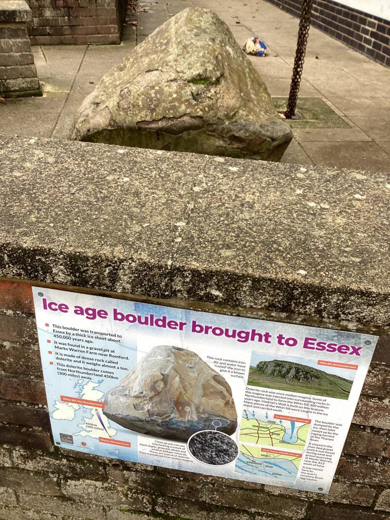
From Northumberland to Essex

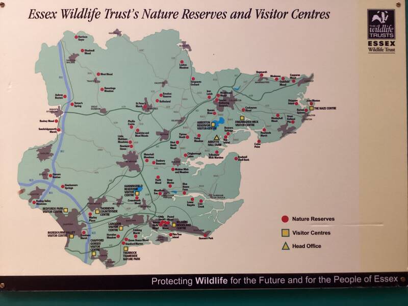
ESSEX Natural Parks
WATER RESERVOIRS

A) Towards PIRGO PARK
A dangerous path!… Alongside Broxhill Road
Broxhill Road. Grand houses (former farms?)


FERNSIDE

An early Victorian building which was the home of Harold Smith who published 'A History of the Parish of Havering-atte-Bower' in 1925 (descendant of Eric Smith). This publication is now sadly out of print, but it is recognised as one of the best authorities on the area.
PYRGO PARK
Recorded as “PORTEGORE”in the 14th c., in the 16th c. SIR BRIAN TUKE, a royal official, occupied the property. In 1536 he was appointed STEWARD OF THE MANOR OF HAVERING. Within a few years the possession had passed into the hands of KING HENRY VIII, and legend has it that he, impressed as he was observing them, decided to reinstate his two daughters to the line of succession. MARY and ELIZABETH partly grew up here.

SOUTH LODGE
HOME FARM
Pyrgo Park, dates from late 18th century but was enlarged around 1867.
B) Towards the village
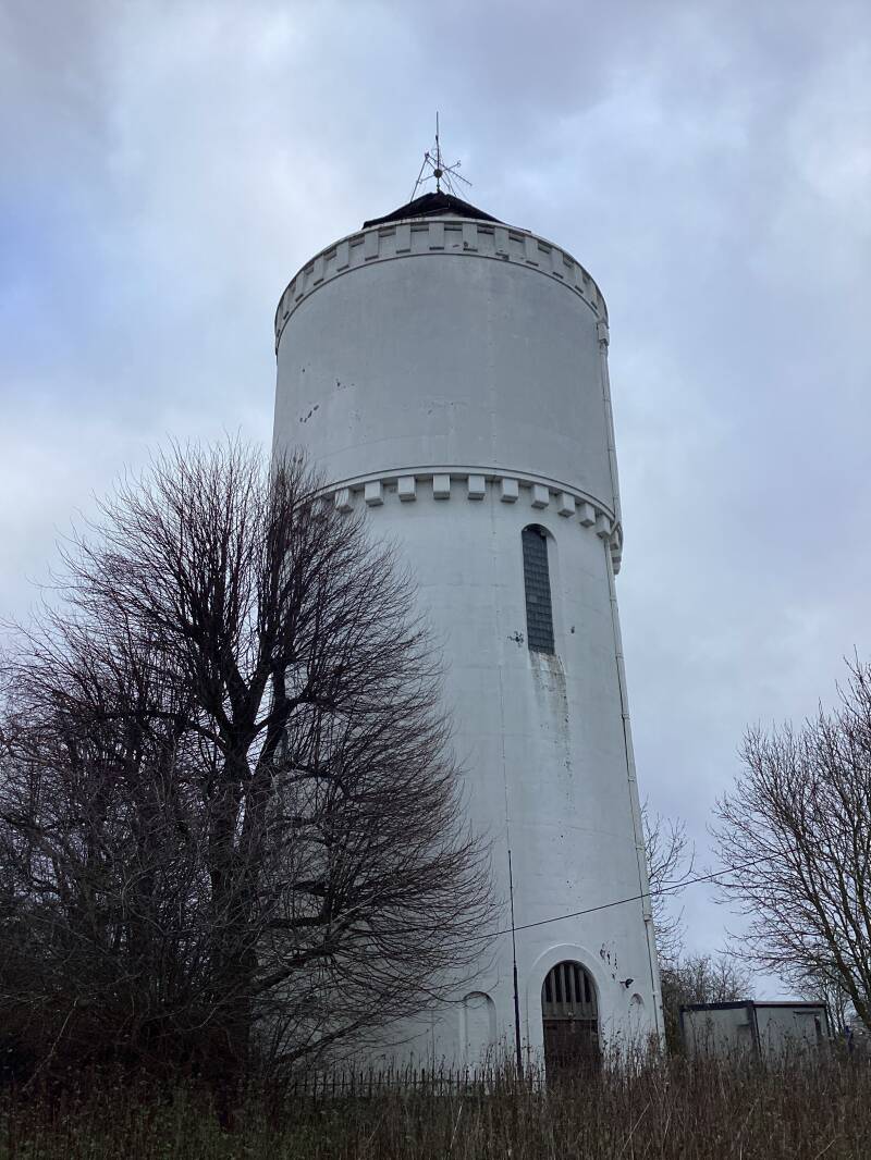


The Water Tower, Broxhill Road, is a prominent landmark that was built by the South Essex Waterworks Company in 1934 to look like a Norman tower.
ROUND HOUSE
The Round House, Broxhill Road, was erected by William Sheldon and purchased in 1807 by William Jacobs who died in 1815 and left the house to his wife's niece, Mary, who was married to William Whitehurst. There is a story that the house was built by a retired tea-merchant who had the house designed in the shape of a tea-caddy to commemorate how he had made his money. It is an elegant and unusual three-storey house which stands on the crest of the ridge, with views north and south. It is visible from the road only when the trees are bare of leaves. It is described in Pevsner's 'Essex' as an oval building, three stories, plastered with eight windows on each storey, having four pairs of giant Tuscan pilasters, a porch of two pillars and two Ionic columns. It was occupied at the beginning of the 20th century by Rev Joseph Pemberton, the famous rose-grower and President of the National Rose Society who grew and hybridised roses there, including the Alexandra Rose as well as various Musk and Shrub roses. He was related to the Pemberton Barnes, who owned the Bower House and Havering Hall.
Now in private ownership.
Recording studio
ROUND HOUSE FARM

No cricket played today…
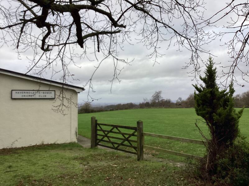
The Cricket Ground and Club House was donated by Mrs Pemberton-Barnes for villagers to use and some very successful cricketers have been members of the cricket club.
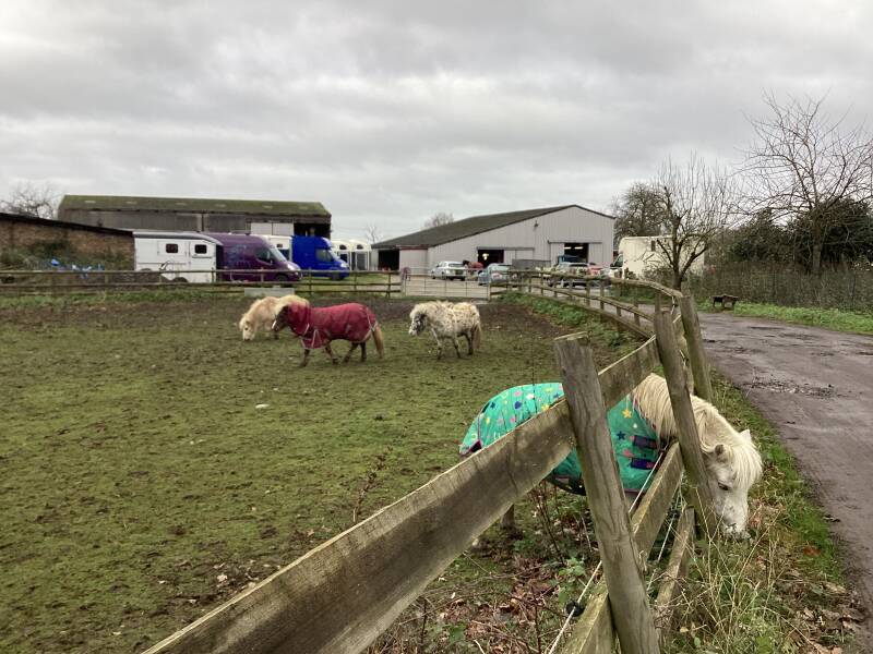
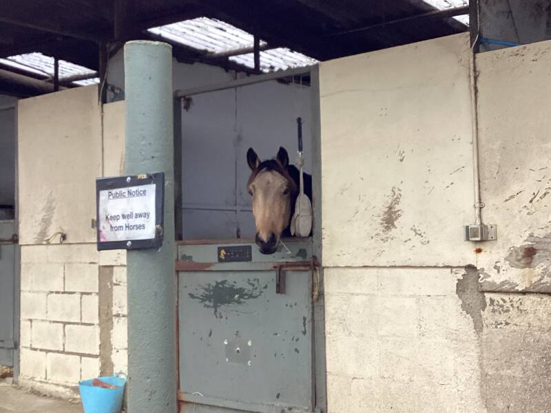
Not only horses

ROMFORD is only 20 min. away

THE HALL, now ST.FRANCIS OF ASSISI HOSPICE


The Hall, Broxhill Road, was owned by Richard Chauncy around 1730.This L shaped building faced the village green, and the old cellar still remains. The cork tree in the grounds is estimated to be around 400 years old, and dates back to a time when there was a great deal of trade with Spain and Portugal.
After several successive owners, during the 18th and 19th centuries, the property came into the hands of Rev Thomas Leigh and was lastly occupied in 1821 by J P Luscombe after which it fell into decay. When the School was rebuilt in 1837 one of the rooms was used as a school room. It was left full of furniture and villagers were told they could help themselves provided they return any item if ask for. The old Hall was then purchased by Mr Field of Pyrgo who sold it to William Pemberton-Barnes, who had the new Hall built around 1858. Saint Francis Hospice purchased the Hall in 1978.

REVEREND JOSEPH PEMBERTON, the rosarían who primarily developed the hybrid musk rose in the 1900s.
By 1896 Pemberton was annually raising between 5,000 and 10,000 seedlings under glass and was growing about 4,000 different varieties of roses in his private collection which surrounded the Round House and The Hall where many generations of the Pemberton family lived. The two properties were connected by a single track which was much used by family members travelling between the two properties. Mostly Joseph would request a pony and trap to travel the short distance between the two properties, so it seems that he did very little walking.
The Village…
THE OLD VICARAGE

The medieval Vicarage was rebuilt by John Heaton (owner of Bedfords from 1771-1818) in 1786, although it is now in private ownership and no longer used as a vicarage. The pump on the front of the house originally came from the church hall.
ROSE COTTAGE

Rose Cottage is a timber framed and weather boarded house which may have been built in the 17th century, partly with medieval material. The present owners won an award for modernising the premises around 1998. The Mason family purchased the cottage in1924 and it served the village as a General Store until the 1970s - before that time it was a sweet shop.
Alongside NORTH ROAD
Former ROYAL OAK PH
The Royal Oak, recorded from 1744, gave up its licence in 1792. A later house of that name, in North Road, has been trading since around 1920.
TIVERTON COTTAGE
Tiverton Cottage down the hill from the village school is one of the oldest houses in the district and was once a 'poor house'.
THE VILLAGE SCHOOL
The Village School was built and endowed by Dame Ann Tipping. An inscription on the wall records its original foundations in 1724 "For ye perpetual Education of Twenty poor children, Boys and Girlsâ€. The school was rebuilt in 1818 and again in 1837 when Queen Victoria contributed £20 towards its cost. When the new building was started the pupils sat on the Green and ate a dinner of roast beef and plum pudding. In 1909 water was piped into the school so that the older schoolboys no longer took the water-cart to and from the village pump. A popular part of the school programme was the annual trip to Southend-on-Sea for which decorated wagons were lent by local farmers to carry the pupils to Romford station.
IVY HOLT???
Ivy Holt dates from the early 19th century. The original dwelling was home to Havering-atte-Bower's best-known eccentric, Elizabeth Balls who lived in the village in 1815 and shared her cottage near the Green with a large company of goats. Her menagerie included 14 goats, two sheep, 17 fowls, and a french dog. She also kept an excellent horse which she tended herself, and she would drive her horse and cart to Romford to collect hay for her goats.

Elizabeth Row, North Road, demolished in 1967, was originally called Abraham's Place, and later Jew's Row.
FAIRLIGHT
Reputedly constructed for Henry VIII's Farm Bailiff and to the rear of the house is the first grass tennis court constructed in this country. Sure?

Dating back centuries, grass tennis courts were the original surface to be played on by nobility before the sport became a common and popular past time. Rightfully dubbed “lawn tennis”, the game was played on a quarter inch of grass that was properly maintained for peek efficiency. Now a days, the experts have got it down to a science. Some of the most famous courts in the world, such as the ones in Wimbledon, are made of a mixture of 70% perennial ryegrass and 30% creeping red fescue.
FAIRLIGHT COTTAGE

Small cottage that adjoins Fairlight and is thought to have been the 'pantry'. Many of the original features have been preserved to this day. On the outside of the house hangs a bell which was tolled to call the farm workers home and the owners salvaged the original 'iron lights'.
Back around the Green

From the Green to… alongside the LONDON LOOP

THE FORGE

The Forge (which also acted as the local Vets) was built around 1780 and had been in the same family for generations. The Rowlands carried on the family business until around 1978. The family also run the village post office for a time from their home on the other side of The Green.
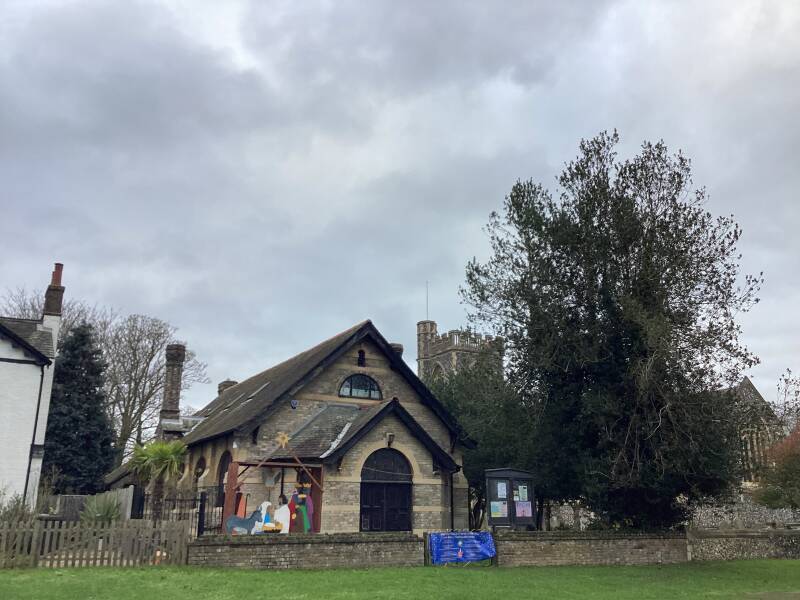
ST.JOHN THE EVANGELIST, PARISH CHURCH
It dates from 1874 but records show that a church has stood on the site for centuries. The present church is an early work of Basil Champneys, built mainly of brick with flint facings, in the Decorated style. The tower has an open East-West passage, a turret and open battlements. A new peal of bells was added in 1897 and a new organ in 1902.
The church suffered damaged by air raids in 1940, and the East window was destroyed.
The oldest part of the church now preserved is the Norman bowl of the font, which is of octagonal tapering Purbeck marble.
Possibly, a larger chapel that formed part of HAVERING PALACE occupied the site.


the white tombstone of the Pemberton-Barnes family
See across THE GREEN…
THE BLUE BOAR HALL


The oldest surviving building in the parish is Blue Boar Hall, Orange Tree Hill, a timber-framed house of the early 17th century, with later additions including a 19th-century brick front. It was an inn in 1712, but was no longer licensed in 1762. It is rumoured that the Inn got its name after an archer shot a blue boar at the site. Queen Elizabeth I was staying at the Palace at the time and sent for the archer to ask if it were true. The archer claimed that the boar turned blue with fear at the sight of his arrow.... "Blue I saw him as plain as I see the cup of good Essex ale your Grace hath ordered your steward to give me at my outgoingâ€. Amused by his humour, the Queen frequently invited him to the Palace.
THE GREEN
The Village Green has been on the present site for centuries. The original green was much larger and sections have been reduced on all sides except the West. Under the commons Enclosure Act of 1811 Havering Green was to remain an ornament for the village forever and not to be enclosed with pale, rail, fence or wall or to be dug up or converted into tillage or excavated for gravel.


CRIME AND PUNISHMENT
The stocks and whipping post stand in the South-East corner. The original stocks are recorded as having decayed around 1670 and were replaced, which incensed the local people who destroyed the replacement as they were placed too close to the narrow part of the road. They were renewed and replaced several more times with the present ones being erected in the summer of 1966.

The Ducking Pond where witches and scolds were plunged into the pond, is now separated from the Green by the road and is partially obscured by a bus shelter which once had a church pew for a seat.0

More crime and punishment in London
WAR MEMORIAL

A London Cabbie lives here…
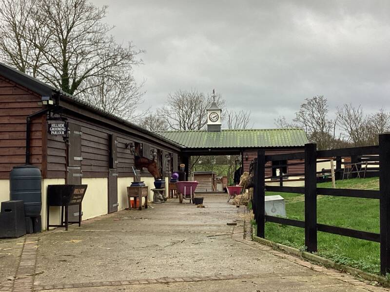
HAVERING PARK RIDDING SCHOOL

Originally the coach house and stable block for HAVERING PARK, the McINTOSH family Manor House.
Stables and house were built in 1850 on the site of the royal palace or royal manor.
250 acres of land surrounded HAVERING PARK. The estate was broken up early 205h century. The grand house was demolished in 1938.
1 acre plots were sold off for development, in 1925.
HAVERING COUNTRY PARK was opened to the public in 1976.
Site of HAVERING PARK, Site of THE BOWER

The village is steeped in royal history and Edward the Confessor was the first monarch known to take interest in the area when he established a timber framed hunting lodge which, over the years would become a substantial retreat for many members of the royal family, a palace or 'bower'. Henry VIII reportedly spent 8 days hunting and banqueting in 1531.
The last monarch to stay here was Charles I in 1631. By then buildings gradually had fallen into disrepair and decay. By 1816 no walls were visible above the ground and a great royal house has lost earth… It appears that Havering had retained this royal connection for almost 8 centuries, as the Domesday Book lists it has been in the possession of King Harold in 1066 and King William in 1086. At that time there were 45 households and the land consisted of 100 acres of meadow with additional woodland and a mill.
It is believed, though disputed, that THE CONFESSOR may have died in the house that he had loved so much before being buried at Westminster Abbey.
What follows is mostly a transcription of

A familiar site in Westminster, around the Abbey historic precincts, is the Coat of Arms of Edward the Confessor, which stand in many places.
It consist of a golden cross”flory” and five gold doves on a blue shield; Azure, a cross flory or between five doves of the same.
The thirteenth century heralds that devised this shield based it on a coin of the Confessor, containing the cross usual to the reverse side of English money, but in the quarters four doves instead of the customary pellets. A dove surmounts the scepter in Edward’s seal, and it is clear that he regarded this bird, emblem of piety and gentleness, as his special symbol. Though posthumously conferred, Edward’s Arms are of some importance on account of their medieval and modern associations. They have been incorporated in the Arms of Westminster Abbey, Westminster School., Westminster City, the Borough of Eye in Suffolk, the West Suffolk County Council; they are even found in Canada, where they appear in the shield of the See of New Westminster. They were adopted by the Abbey of Dunfermline, founded by the great-niece of Edward the Confessor, who became the wife of Malcolm Canmore. They were also the basis of the Arms of Edmund Rich, the sainted Archbishop of Canterbury, founder of St. Edmund’s Hall, Oxford, which still bears a red cross “patonce” and four black martlets ( birds) on gold; Or a cross patoncesable between four martlets of the same.
The other palace purchased by Henry VIII, east of the village, to relieve the now ageing Havering Palace, was PYRGO. Into the 17th century the Royal Palace of Havering was in decline and was eventually pulled down. PYRGO was also demolished later, in the 18th century. Only one set of plans exists from the original Havering Palace, courtesy of a survey by Lord Burghley in 1578.
James I was a frequent visitor to Havering Park between 1605 and 1624, but after the death of Charles I the land was divided and sold in 1650.

The succession of Edward the Confessor (according the government of the United Kingdom)

THE LIBERTY OF HAVERING, a crown possession until the 19th c.
The Liberty of Havering was confirmed by Kind Edward IV in 1465 and by his Charter residents had their own Court to administrate both civil and criminal matters, and the Courts even passed the death sentence. Other privileges included permission to hold a three day fair each year. The Liberty was also exempt from Royal Purveyors who commonly took goods for the King at their own price. These privileges were renewed and extended by succeeding monarchs. In 1588 Queen Elizabeth I made Liberty a Corporation and gave it her seal. Traders were granted 'doquets' which exempted them from paying tolls in England. The Liberty fell out of favour in the reign of James II (1685-1688) with the destruction of the royal palaces. In 1833 the commission considered absolution of the Liberty, which was strongly resisted by the officers and continued for another fifty years. The Liberty officers had some interesting roles. The 'Ale Connor' or taster would enter an Inn, draw a flagon of ale, pour some of it on a wooden bench and sit in the puddle for 30 minutes. If the ale was impure and contained sugar the taster would be stuck to the bench. The Liberty finally ceased to exist on 1 July 1891 (when Joseph Pemberton would have been around 39). The last two sentences passed by the Court were 10 months hard labour for a man who stole three rabbits and 10 years hard labour for a man who stole two bullocks.
More about the LIBERTY…
“As a county within a county, Havering was sometimes seen as a soft target for dubious activities, such as prize-fighting.
As with illegal raves today, venues for bare-knuckled boxing contests were only revealed at the last minute.”
Keep reading this great article on

More about “Liberties” in medieval England

A liberty was an English unit originating in the Middle Ages, traditionally defined as an area in which regalian right was revoked and where the land was held by a mesne lord (i.e., an area in which rights reserved to the king had been devolvedinto private hands). It later became a unit of local government administration.[1]
Liberties were areas of widely variable extent which were independent of the usual system of hundreds and boroughs for a number of different reasons, usually to do with peculiarities of tenure. Because of their tenurial rather than geographical origin, the areas covered by liberties could either be widely scattered across a county or limited to an area smaller than a single parish: an example of the former is Fordington Liberty, and of the latter, the Liberty of Waybayouse, both in Dorset.

Liberties in the London area
You can enter the Country Park now (after passing by the stables and a few houses), but the walk continues alongside BOWER FARM ROAD


And more Stables…


You are walking in the direction of HAINAULT PARK


BOWER FARM


The CITY OF LONDON and CANARY WHARF, 15 miles away


WELLINGTONIA AVENUE
The McIntosh family planted this avenue, with these trees imported from California. Also known as GIANT REDWOODS, they can live for up to 3000 years, and have a very soft, spongy, thick fire proof bark


National Trust


Dr. Kellogg, the founder of the California Academy of Sciences, was instrumental in the discovery of the tree. He planned to name the 'Washingtonia' in honour of America’s revered first President.
Kellogg only needed to complete his set of herbarium specimens to register the new species. Lobb knew this, and quickly returned to England with the required specimens before his rival could carry out his plans.
To add insult to injury, John Lindley of the Horticultural Society, who was assigned the task of naming the introduction, opted for the decidedly un-American Wellingtonia gigantea to commemorate the lately deceased Duke of Wellington.
US parks history

UK giant redwoods


A “PLOTLANDS” COMMUNITY here?
Not in London
After the death of Mrs McIntosh, the estate was carved up piecemeal, part of it being sold off in one-acre plots at around £30 each that became known as the Plotlands. These plots were along Wellingtonia Avenue and Pinewood Road and were extremely popular from the 1920s to 1940s.
Many of them were initially bought by East Enders as a welcome retreat from the inner city who ‘visited their plots at weekends, staying in tents and slowly building their own bungalows. Some moved in permanently.’ Two of the old bungalows still exist, one of which serves as the Park Office.
In 1970, the Greater London Council, much to the displeasure and outrage of local people, was behind a Compulsory Purchase Order to clear out the Plotlands in order to create a regional public park following recommendations in the Abercrombie Report to restore Havering Ridge to its former beauty.
Orange Tree Hill

BOWER COTTAGE


It dates from the early 19th century.


An ALLTRAILS route…

Routes 375 and 294 to get here
Get to know this 13.5-km circular trail. Generally considered a moderately challenging route, it takes an average of 3 h 20 min to complete. This trail is great for mountain biking, road biking, and running, and it's unlikely you'll encounter many other people while exploring. The trail is open year-round and is beautiful to visit anytime.
A circular walk around ESSEX COUNTRYSIDE

See the map at the end of the post